


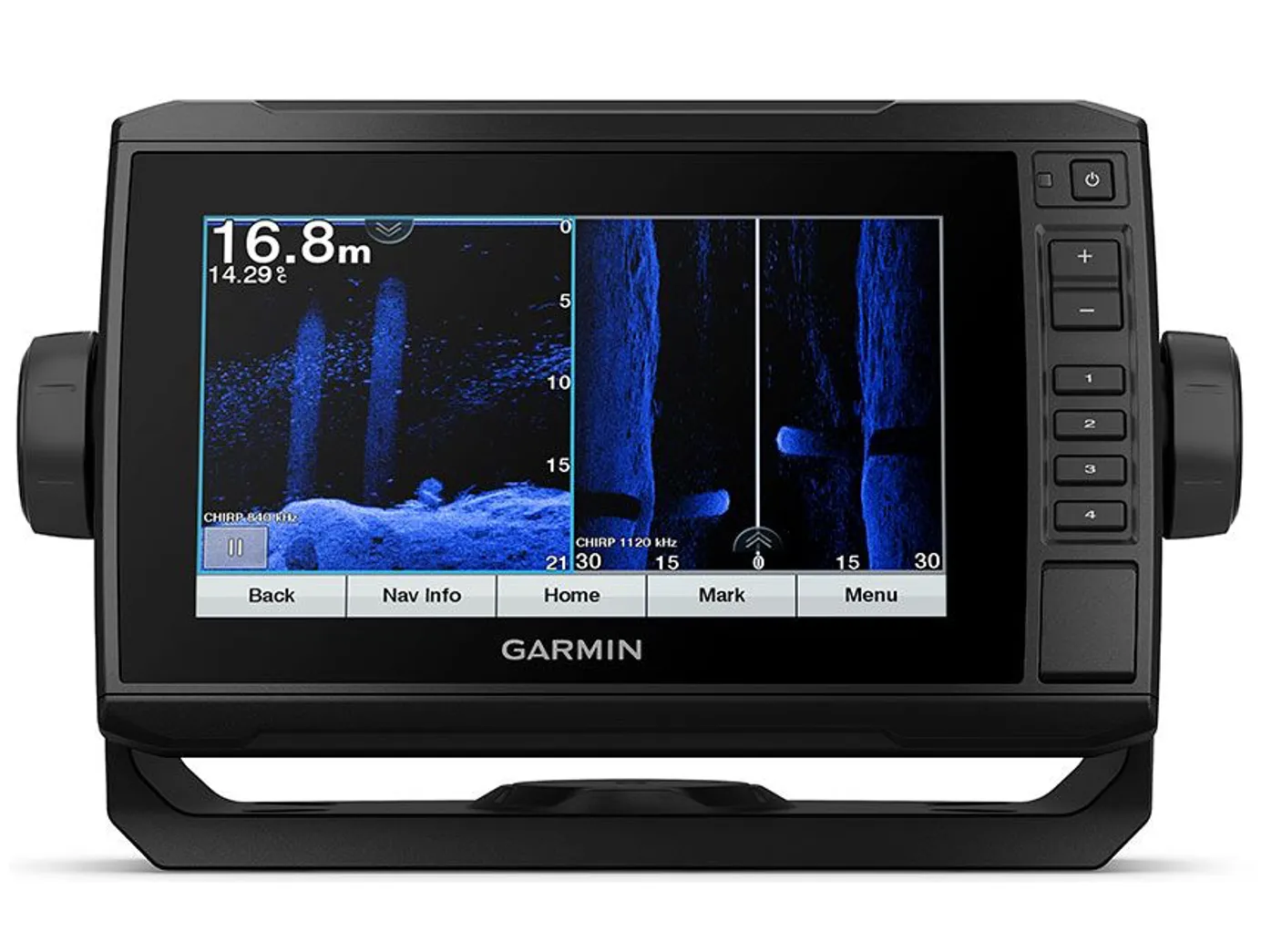
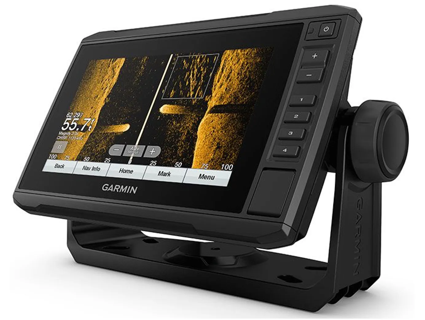
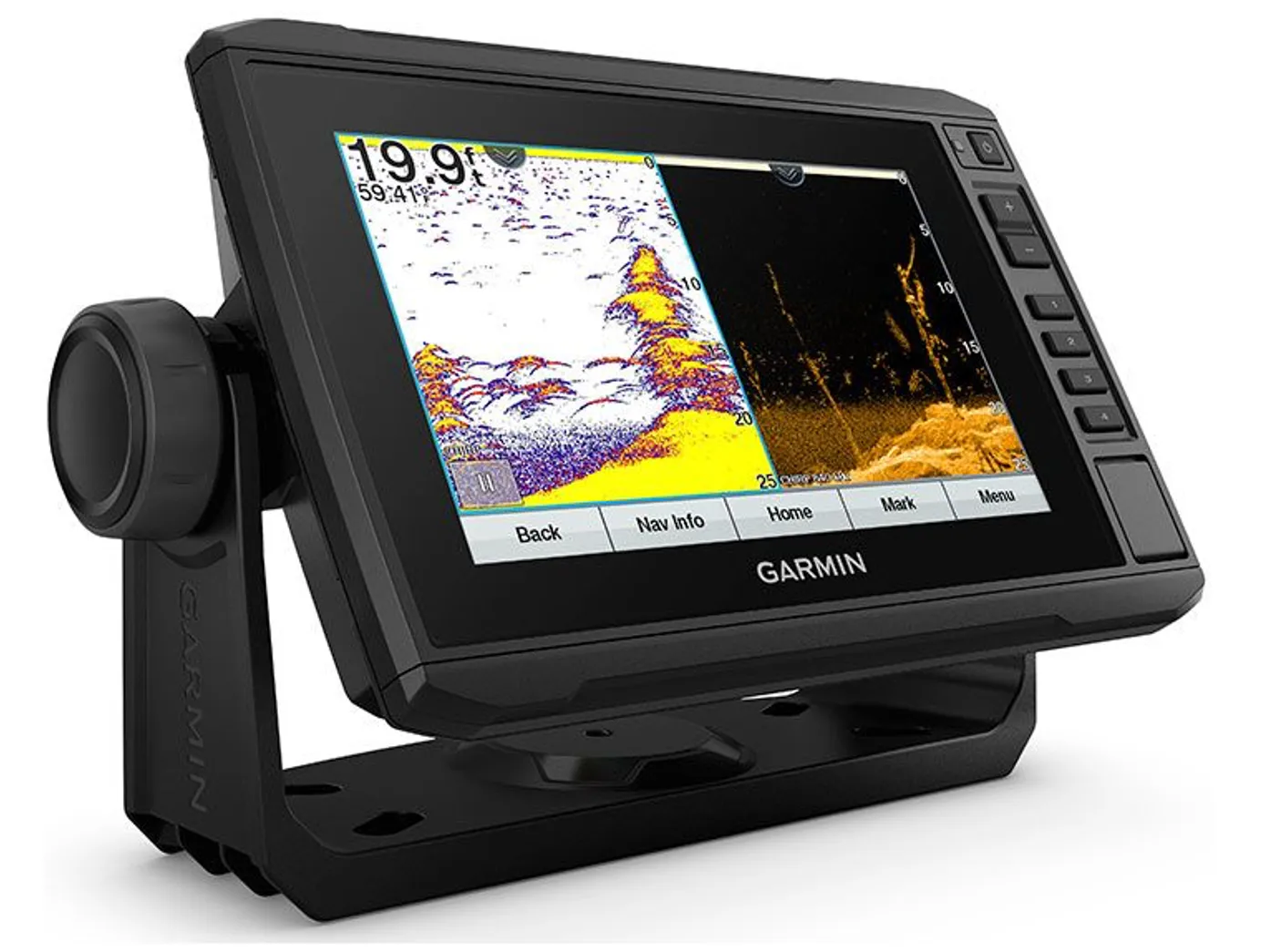
Find more fish using the ECHOMAP UHD 75 combo. It features a bright, sunlight-readable 7” touchscreen with keyed assist plus support for Ultra High-Definition ClearVü and SideVü scanning sonar or Garmin high wide CHIRP traditional sonar.
Sonar Support
This chartplotter supports a variety of Garmin transducers (sold separately), including the Panoptix LiveScope™ scanning sonar system, which lets you see all around your boat in real time.
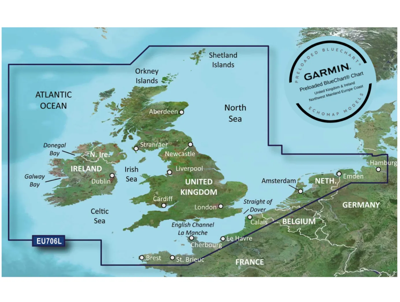
Preloaded Mapping
Experience unparalleled coverage and detail with preloaded BlueChart® g3 charts for the United Kingdom, Ireland and Northwest mainland Europe coast featuring integrated Garmin and Navionics® content.
Quickdraw Contours
Create personalised fishing maps on-screen with 1’ contours. Keep the data to yourself, or share it with the QuickDraw™ Community on Garmin Connect™.
Boat Connected.
Network Capable
If you have multiple compatible ECHOMAP UHD or ECHOMAP Ultra devices on your boat, you can share information — such as sonar, user data and charts — among them (7” and 9” models only).
NMEA 2000® and NMEA 0183 Networks
Connect to autopilots, digital switching, weather, FUSION-Link™ audio system, media, VHF, AIS and more from one screen.
Activecaptain® App
Built-in Wi-Fi® connectivity pairs with the free all-in-one mobile app for access to the OneChart™ feature, smart notifications1, software updates, Garmin QuickDraw Community data and more.
Force™ Trolling Motor Compatibility
Take control of the most powerful and efficient trolling motor available2, route it to waypoints, follow tracks and more from the screen of your chartplotter.
Key Features
- Preloaded Navionics charts for the United Kingdom, Ireland and Northwest mainland Europe coast
- Share data with other devices on the network
- Manage the marine experience from nearly anywhere
- Control the most powerful trolling motor available
- Create sonar maps on the fly
- ECHOMAP UHD 75sv with UK Chart
- Charging/data cable
- Tilt/swivel mount with quick release cradle
- Flush mount
- Protective cover
- Hardware
- Documentation
Transducers
- Not supplied. See website for Range
Specification
| General | |
|---|---|
| Dimensions | 25 x 13.9 x 5.1 cm |
| Input | Touchscreen with Keyed Assist |
| Display Size | 15.5 x 8.6 cm, 17.8cm (7") Diagonal |
| Display Resolution | 400 x 800 pixels |
| Display Type | WVGA Display |
| Weight | 0.77Kg |
| Water Rating | IPX7 |
| Mounting Options | Bail, or Flush |
| Maps & Memory | |
|---|---|
| Accepts Data Cards | 1 microSD Card, Max: 32GB |
| Waypoints | 5,000 |
| Track Points | 50,000 |
| tracks | 50 Saved Tracks |
| Navigation Routes | 100 |
| Sensors | |
|---|---|
| Built-in Receiver | ✓ |
| Receiver | 5 Hz |
| NMEA 2000 Compatible | ✓ |
| NMEA 0183 Compatible | ✓ |
| GPS | ✓ |
| Supports WAAS | ✓ |
| Built |
|---|


